Source of the Healthy
Source of the Healthy
Recommended parking: in the center of the village, behind the Information point and next to the village hall Departure : Foncine le Haut Difficulty : Difficult Directions to follow: From the Information point FONCINE-LE-Haut, the circuit goes up the Grande Rue 150m and ends on Place Le Village (shops and fountain).
This route crosses pastures with livestock, and takes forest paths. Also for the respect of the owners and operators who authorize you to pass, for the tranquility of the herds and wildlife, you are invited to stay on the marked trails.
Use the passages provided to cross the fences and make sure to close the barriers. Finally, please keep your dog on a leash if you have one.
Wildflowers are beautiful, they can be rare and protected and often wilt quickly. Don't pick them! They will delight future hikers.
In the event of forestry work (felling, skidding, etc.), for your safety, know how to give up and turn around.
- It branches off to the left (white and red markings) and comes along the Saine, then follows the road which leads At Vallet.
- At the exit of the hamlet, the shaded path bordered by low walls goes to the right and climbs to the Pâture-du-Bayard.
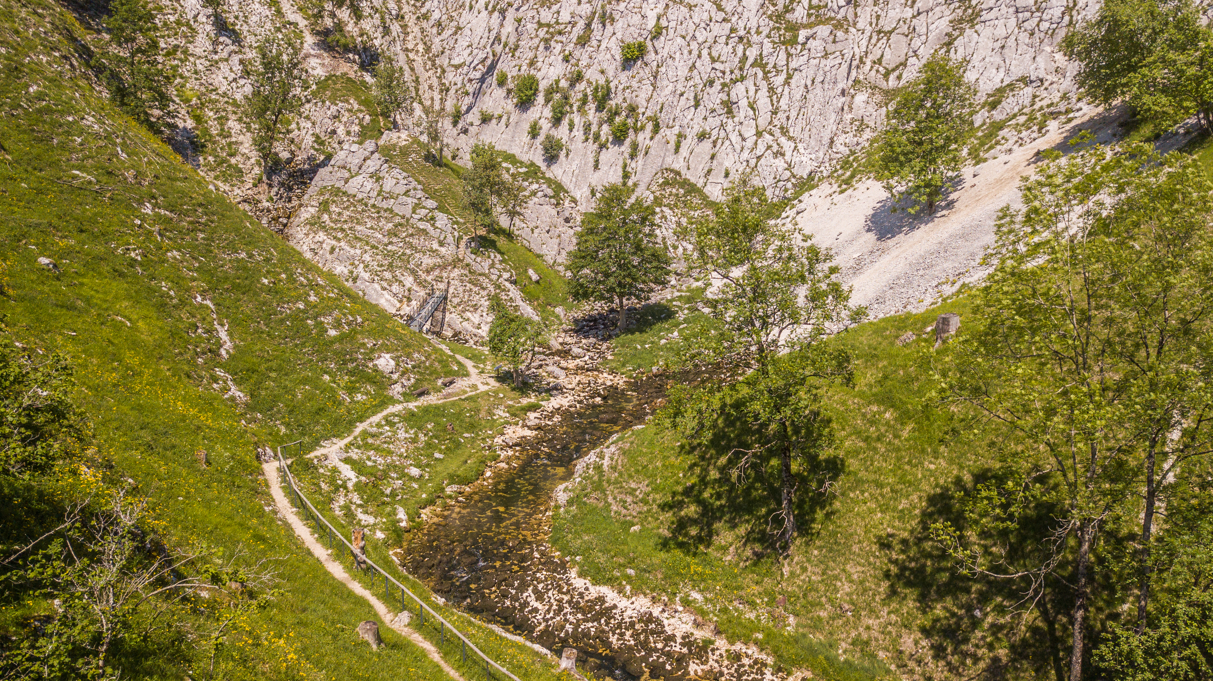
- La SOURCE OF HEALTHY is accessible (yellow markings) in 15 minutes round trip (interpretation panels - La source de la Saine). Returning from the source, a path goes up to the right (yellow-red markings) towards Le Bayard. The route runs along a pasture, overlooking the Foncine valley, then follows a grassy path.
- À Sous-le-Bayard, the stony path branches off to the right and climbs quickly to reach the Roman Life. Then the path gradually climbs to the left to the botanical trail of BAYARD.
- The small road on the right joins in 50 meters La Combette aux Loups. On the left, the path allows you to reach the VIEWPOINT OF LA ROCK FENDUE in a pleasant undergrowth.
- We retrace our steps a few meters to continue to the right on a crest until Bayard Coast to turn right and via a long gradual descent through the juniper trees, reach the Col du Renvers des Ruines.
- Le Couillou Belvedere is accessible 5 minutes round trip on the right. Returning to the pass, the road on the right goes down to Chemin du Col then (yellow markings) crosses the hamlet THE RUINS (XNUMXth century chapel).
- At the exit of the hamlet, the country path turns right and serves Grange-Charnoz then finds the road at an oratory (dated 1747) to reach The Lower Town.
- We continue the road on the left, then a path towards Life in Gayet. The route turns right, crosses the road, goes down to a sawmill, and crosses the D 437 at the Choudet Mill.
- Continue opposite to join the Saine and cross it at Thiémont Bridge. Follow the path on the left towards the Isles, bordering the left bank of the river, to find the start.
This route crosses pastures with livestock, and takes forest paths. Also for the respect of the owners and operators who authorize you to pass, for the tranquility of the herds and wildlife, you are invited to stay on the marked trails.
Use the passages provided to cross the fences and make sure to close the barriers. Finally, please keep your dog on a leash if you have one.
Wildflowers are beautiful, they can be rare and protected and often wilt quickly. Don't pick them! They will delight future hikers.
In the event of forestry work (felling, skidding, etc.), for your safety, know how to give up and turn around.
For lunch nearby:


